


Discover Johnson Valley app for iPhone and iPad
Developer: Discover Nature Apps
First release : 01 Dec 2014
App size: 12.16 Mb
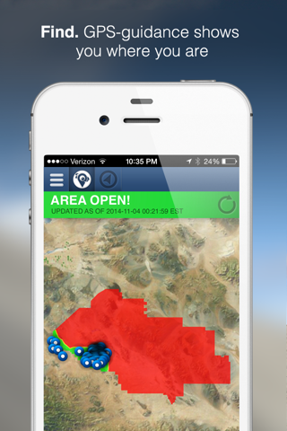
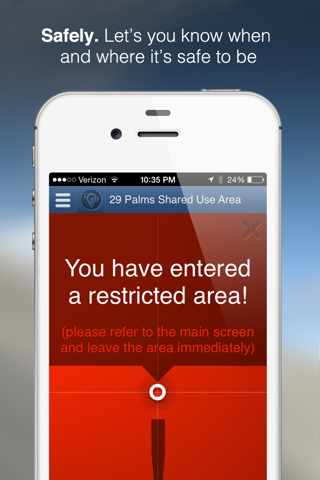
Developed for the U.S. Marine Corps, DNAm, the Discover Johnson Valley – Shared Use Area (SUA) app is a public safety tool with which to inform visitors to the recently-established SUA about its open or closed status. The app also utilizes smartphone Global Position System (GPS) technology to show users their location within the area, and alerts them when they have crossed into off-limits Combat Center property. Critically, once downloaded, cell service is not required for users to track their location.
Other safety tools include base alerts and the ability of users to post GPS-tagged field tips and photographs about hazards like unexploded ordnance. Users can also use field tips and photographs to highlight interesting wildlife sightings and document their activities.
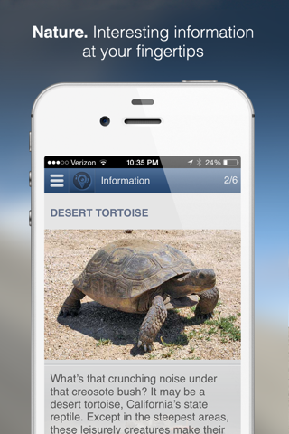
In addition to serving as a public safety tool, the app includes extensive content about the Combat Center in Johnson Valley and its conservation activities; desert safety precautions; and interesting background on desert wildlife and habitat. Furthermore, Fun Facts pages offer an entertaining way to learn about the Combat Center, Johnson Valley and desert resources.
Packaged with beautiful and compelling imagery, as well as elegant design and an intuitive user interface, Discover Johnson Valley is a vital tool for users of the SUA, as well as anyone who has an interest in learning about the Combat Center and the base’s diverse desert wildlife and habitat.
Included:
• Base and Shared Use Area map showing open or closed status.
• GPS-guided user tracking with automatic alerts if entering restricted areas.*
• Ability to post GPS-tagged field tips and accompanying photographs, viewable by other users and base administrators **
• Real-time conditions and on-the-ground users’ field tips and photographs viewable by anyone who has the app downloaded, regardless of their location.
• User photo album, stored within the app.
• Fun Facts that entertain and educate users about the Combat Center’s operations, mission and history, in addition to desert flora and fauna.
• Informational pages that provide detailed Combat Center background, operations and history, as well as information about the Johnson Valley, desert safety precautions and wildlife and habitat.
• Local resource section includes information about local services including restaurants, hotels, rentals and others.
• Efficient content build means a quick download.
* Location maps and alerts will operate without cell coverage after the initial download.
** If cell service is not available for upload at the time of the sighting, tagged images and tips will do so once service is recovered.
*** Continued use of GPS running in the background can dramatically decrease battery life.